High Street of the Parks
Come percorrerlo
3
Distanza
500
Durata
2-7
High Street of the Parks
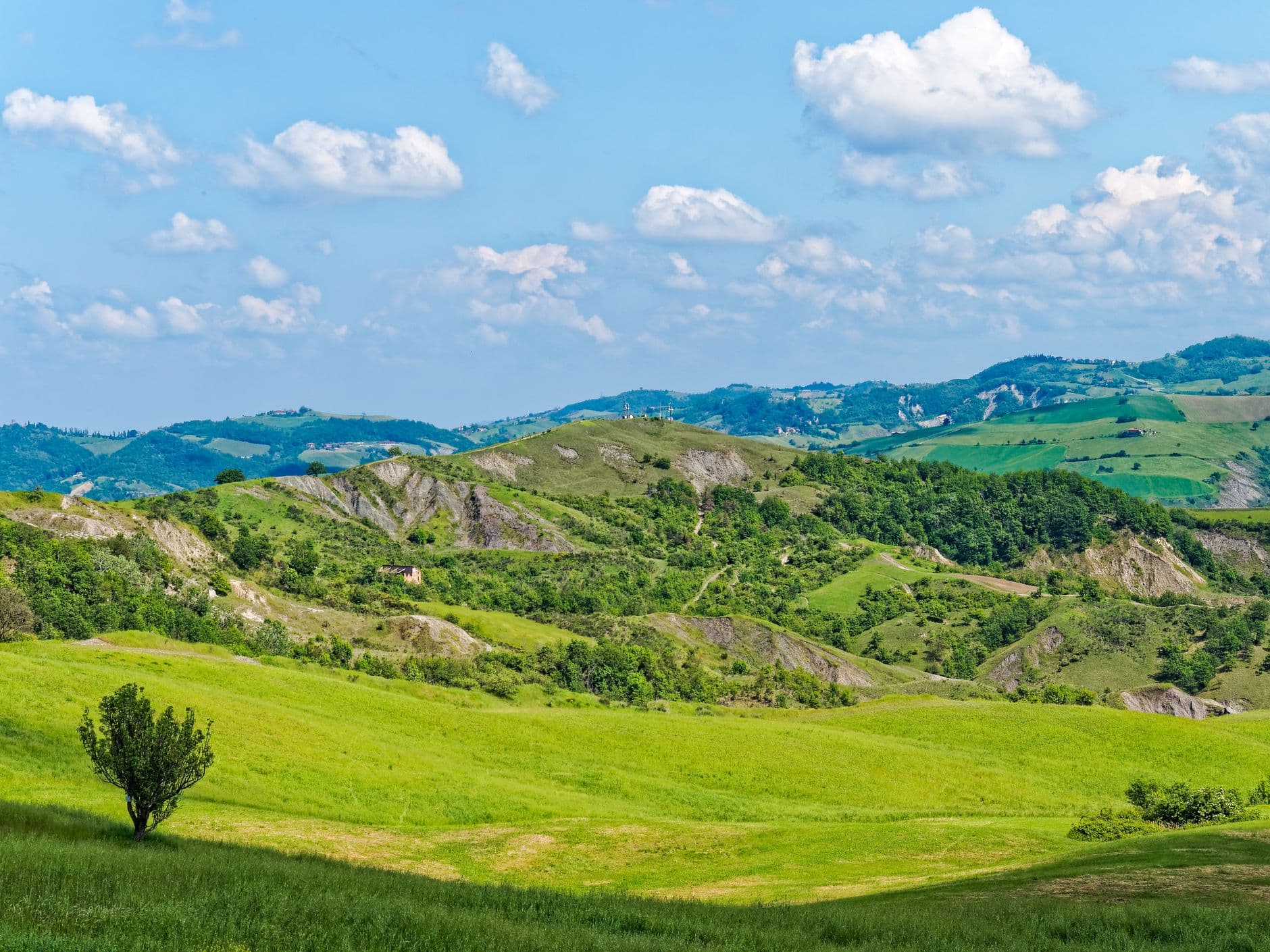
The Alta Via dei Parchi is an itinerary to be covered on foot along the Apennines between Emilia-Romagna, Tuscany and the Marches. It crosses two national parks, five regional and one interregional and allows you to discover the best that the Apennine mountains have to offer.
The Alta Via dei Parchi starts from Berceto, near the Cisa Pass, in the Province of Parma, and reaches the Verna cliff, jutting out over the Casentino to then reach the hermitage on Monte Carpegna, in the Sasso Simone and Simoncello Park .
An itinerary in 27 stages through the Apennines between Emilia-Romagna, Tuscany and the Marches, which touches 10 provinces (Parma, Reggio Emilia, Modena, Bologna, Ravenna, Forlì-Cesena, Rimini, Lucca, Massa Carrara and Pesaro-Urbino): 500 kilometers of ups and downs that unite two national parks, five regional parks and one inter-regional one.
The route and stages
The Alta Via dei Parchi is an itinerary to be covered on foot along the Apennines between Emilia-Romagna, Tuscany and the Marches. There are almost 500 kilometers of ascents and descents that sum up the best that the Apennine mountains have to offer, glacial cirques, lakes immersed in the splendor of the high-altitude prairies, endless forests and clear streams, volcanic cliffs and chalk cliffs.
There are eight parks crossed by the Alta Via: two national ones: the Tuscan-Emilian Apennines and Foreste Casentinesi, Monte Falterona and Campigna; five regional ones: Upper Modenese Apennines, Cedra and Parma valleys, Corno alle Scale, Suviana and Brasimone lakes, Romagnola Vena del Gesso and an interregional park: Sasso Simone and Simoncello.
Anyone can experience it, at least in individual stages. The route is in fact divided into 27 stages. It connects with the Alta Via dei Monti Liguri at Passo della Cisa, with the Via Francigena at Berceto and with the Via Romea Peregrinorum at Passo di Serra.
The route therefore also involves Tuscany and the Marches; for the Emilia-Romagna part it follows almost entirely path 00 and the GEA (Great Apennine Excursion) which involve the ridge between Emilia-Romagna and Tuscany. In particular, the route almost entirely coincides with the GEA in the Emilian section from Passo della Cisa to Monte Cavallo, with a small detour on the ridge to then resume in the Casentino Forests. For each stage of the itinerary, the existing accommodation facilities are indicated.
The route can be clearly identified by hikers thanks to special coordinated signs and is completed by a series of facilities at the service of visitors. The eco-tourism offer linked to the naturalistic and cultural beauties of the Parks is also proposed as an innovative component of a holiday that goes well with a visit to the art cities of the area crossed.
The more experienced hikers will find trekking proposals ranging from two to seven days and crossing several stages. Their common denominator is that they can also be reached by public transport.
THE STAGES:
- Berceto – Lake Santo Parmense
- Santo Parmense Lake – Prato Spilla
- Prato Spilla – Cerreto Pass
- Del Cerreto Pass – Pradarena Pass
- Pradarena Pass – Lama Lite
- Lama Lite – San Pellegrino In Alpe
- San Pellegrino In Alpe – Lake Santo Modenese
- Lake Santo Modenese – Abetone
- Abetone – Lake Scaffaiolo
- Scaffaiolo lake – Monte Cavallo refuge
- Ref. Monte Cavallo – Poranceto
- Poranceto – Boccadirio
- Boccadirio – Alpe Di Monghidoro
- Alpe Di Monghidoro – The Forests
- The Woods – Tossignano
- Tossignano – Carnè
- Meat – Marradi
- Marradi – Lake Ponte
- Ponte Lake – San Benedetto In Alpe / Toschi Hermitage
- San Benedetto In Alpe / Toschi Hermitage - Castagno D'andrea
- Chestnut D'andrea - Campigna
- Campigna-Camaldoli
- Camaldoli – Badia Prataglia
- Badia Prataglia – La Verna
- La Verna – Snow White Refuge Al Fumaiolo
- Snow White Refuge Al Fumaiolo – Bascio
- Bascio – Madonna Del Beech Hermitage
Update
Since the beginning of 2018, the Monte Cavallo refuge, located between stages 10 and 11, has been unusable.
We offer you two alternatives: reach the Le Casette del Doccione refuge (for information and reservations 0534 29198, Virginia 335 6108138, e-mail nisky.v@libero.it): from Passo Tre Croci turn left and follow the dirt road (about 40 minutes); it is possible to stay overnight only in a tent, with yours or in the one provided by the managers; continue to Ponte della Venturina (about 2 hours 30'), from which Porretta Terme is easily reachable both by train and by bus: in the village you will find various accommodation facilities. The next day you will have to go up to Passo Tre Croci to resume your journey on the Alta Via dei Parchi: considering the length of the stage that awaits you, we advise you to break it up by staying overnight at Lake Suviana.
Share this article: